This blog post has originally been written in November 2010 in Finnish, but since the topic is very interesting and it is rather difficult to find detailed information about visiting the North Korean border online, I have translated my post in English in January 2016. Since rules and regulations for visiting the border change often (sometimes even weekly), it is highly encouraged to visit the official tour company websites for up-to-date information. This blog post intends to give the reader an idea what one sees at the border and share some of the bizarre stories around this last remaining frontier of the Cold War.
❗ Tour operators – There are many companies operating a tour to the DMZ. We used tourdmz but also USO is providing a very popular (and slightly cheaper) one. Please note that not all tours visit all the areas and the main site to see is the Panmunjom/JSA directly on the border.
❗ Restrictions – There are some restrictions for clothing (non-provocative) and camera gear (lens maximum focal length 100mm) on the tours entering the DMZ which are also being enforced. Please continue reading for more details on this.
In April 2010 me and my wife were traveling in Japan and South Korea. The last stage of our trip was Seoul where we had four days to explore this interesting city. But we didn’t want to see the city alone, but also visit the heavily-guarded border with North Korea which stands only 60 kilometers (37mi) north of the capital. The Korean Demilitarized Zone (DMZ) is located around the 38th parallel and is a result of the Korean War that ended in an armistice in July 1953. As South Korea boycotted the continued separation of the Korean peninsula, no peace treaty was signed and even today the two Koreas are technically at war. Since then the peace has lasted for over 60 years, although there has been numerous small clashes during the years between the two, resulting in hundreds of dead soldiers on both sides.
In the agreed demilitarized zone South Korea ended up gaining slightly more land than it had before the ceasefire. DMZ itself is a 248 kilometers (154mi) long corridor that spans across the whole Korean peninsula. The official border line in the middle of the DMZ is called the Military Demarcation Line (MDL) and it is surrounded by approximately two kilometers of demilitarized land on both sides of the MDL, making the corridor four kilometers in total width. DMZ is the world’s most heavily guarded zone where both sides have constantly approximately one million soldiers ready for action at a moment’s notice. Despite the name ”demilitarized”, soldiers on both sides are allowed to patrol inside the DMZ, however nobody is allowed to cross the official border line MDL.
Since the history of these two countries is so complicated, we were very intrigued to visit the border to witness this madness with our own eyes. Curiously enough, it is perfectly fine for anyone to travel to the outer border of the DMZ, but to enter the two-kilometer zone (where all the most interesting places are) requires joining a tour.
The most popular tour is offered by the USO organization that provides services for United States troops abroad. Their tour covers all the main locations on DMZ and the guides on these tours are active US soldiers based on the DMZ. To my understanding the tour offered by USO is also the cheapest, costing only around 50 Euros per person (in October 2010). The downside with all tours (but especially the one offered bu USO) is that tours can be cancelled on moment’s notice due to a military exercise and they only run on few days a week. Information on the USO tours can be found on the Koridoor website.
Because of our schedule we couldn’t join the USO tour and had to consider alternatives. There are several tour operators that organize tours out of Seoul and we chose to go with tourdmz whose Combined tour / 3rd tunnel & Panmunjom tour covers all the main sites in and around DMZ, including visiting the North Korean border in Panmunjom. The cost of this tour is 76 Euros (in October 2010) and they run daily.
After booking the tour online one month ahead of our travel, in the morning of our tour we made our way to their office located inside the Lotte Hotel (Euljiro 1-gan subway station). Tourdmz office is located on the sixth floor of the hotel (together with many other tour operators) and you are given your tour ticket against an email confirmation from them.
Our tour day was a Saturday and so there were dozens of participants and we were being split into two tour groups. One of them was for the Korean speaking participants and the other for us English speaking ones. Boarding the bus we managed to secure seats at the very front, providing us with excellent views throughout the tour. 🙂
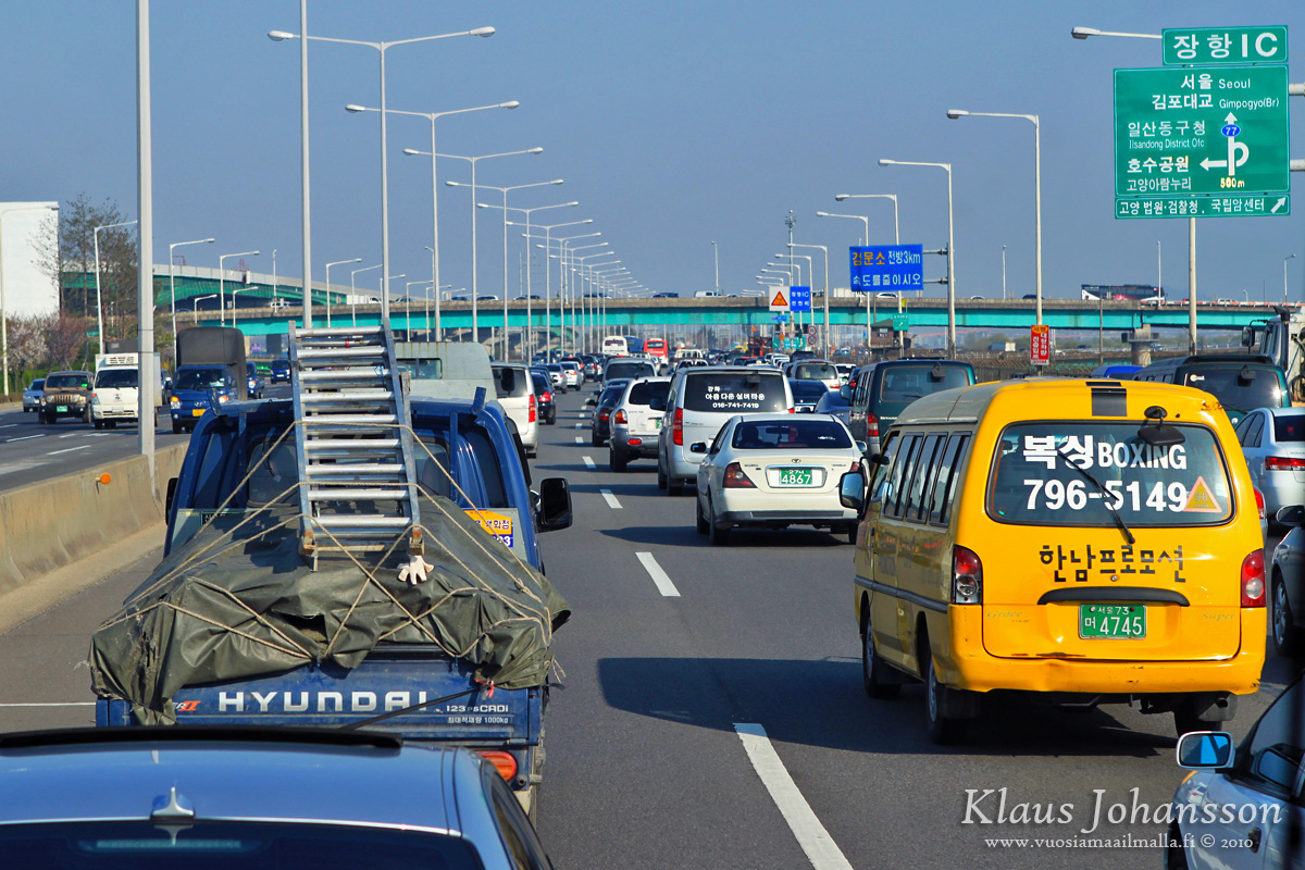
Getting out of a badly congested megacity like Seoul will take some time and after an hours or so we were finally heading north along the busy 12-lane Freedom Highway. The further north we drove, the calmer the traffic got and after some time there were only few cars anymore heading north on the 8-lane highway which continues all the way to the border.
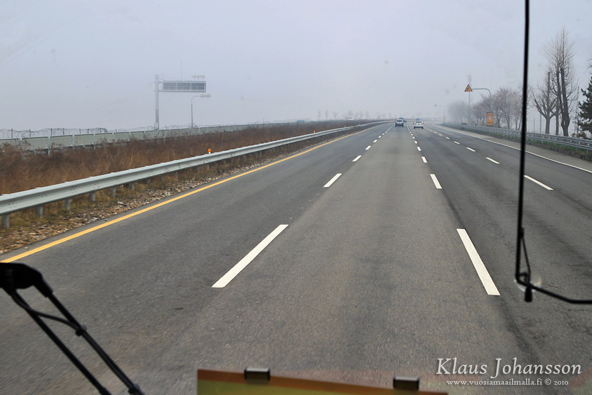
Rush hour on Freedom Highway
The traffic amount doesn’t really justify such a wide highway and the reason for is purely a military one. In case of an attack from the north, South Korean troops need to be deployed quickly to the border from the barracks around Seoul, hence the wide highway. Of course the same would also benefit the enemy, which is why there are huge pieces of concrete hanged over the highway every few hundred meters apart that can be detonated in case of an attack, to hinder enemy’s progress. On the side of the road there are also different types of fortifications that can quickly be deployed on the road. Also the constant military guardhouses along the highway with soldiers carrying big guns is a reminder that this is no ordinary highway. 🙄
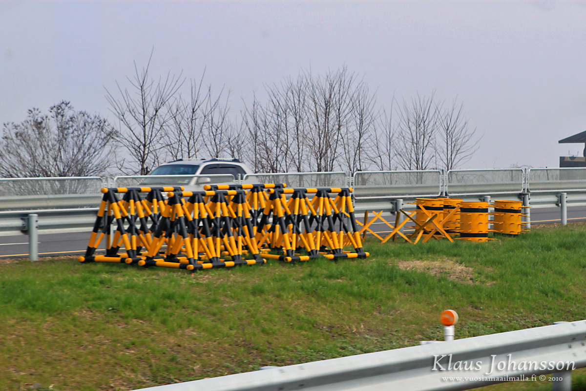
Fortifications along Freedom Highway
One had to keep in mind that Seoul is located only 60 kilometers (37mi) from the border, so in case of an surprise attack much can happen during the first hour of the attack. This is why all the preparations are essential and soldiers need to be patrolling the area 24/7.

Guardhouses are a regular sight on the highway
Freedom Highway ends at the Unification Bridge (note the sublime name of both the highway and the bridge) where the first passport checkpoint takes place. Visiting the DMZ is not a problem with a Finnish passport, but there are restrictions for some countries. The type of passport one carries makes a much bigger difference on the North Korean side (where one can only travel through China) and based on some comments I have read, having a South Korean stamp on your passport may prohibit one from entering the area or the whole country. However rules and regulations on the north side change constantly, so one has to check official websites for ”today’s special”. 🙄
Once everyone’s passports have been checked, the bus can cross the Unification Bridge. The bridge is full of fortifications and armed with detonators, so it can be destroyed in case of an enemy attack. Crossing the bridge and the Imjingang River takes one closer to the DMZ, but you will not be inside the zone yet.
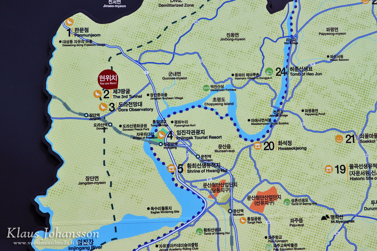
Map of the area around Unification Bridge
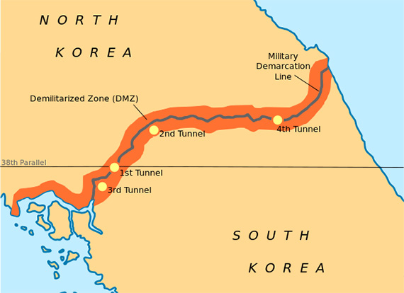
The first stop on our tour is the Third Infiltration Tunnel which has an interesting story. In November 1974 South Korean soldiers on a normal patrol noticed steam coming out of a small hole in the ground. Soon after this they were fired at from the North Korean side, prompting a larger investigation into the matter. Not long after it was discovered that the steam was actually coming from an underground tunnel stretching 435 meters (1,427ft) under the South Korean DMZ.
The tunnel was dug to enable moving troops under the border at the moment of an attack, however North Korea at first denied knowing anything about the tunnel. Soon they changed their story, claiming it being an old South Korean coal mining tunnel. But this was hard to believe, since there is no coal in the area and the tunnel had been bored through a hard granite stone with blast marks on the walls indicating the construction work having taken place from north. In a desperate attempt to fool the inevstigators, North Korea had even tried painting the walls black as a sign of coal, but the bluff was an obvious one. 💡
Since then altogether four similar tunnels have been found all across the DMZ, with the latest being found in 1990. Official estimates say that there are probably dozens of such tunnels, but despite extensive investigations no further tunnels have been found. The most famous of these tunnels is the third tunnel which tourists are able to visit. Also the second and the fourth tunnel can be visited, but they are located elsewhere and are not part of any Panmunjom tour.
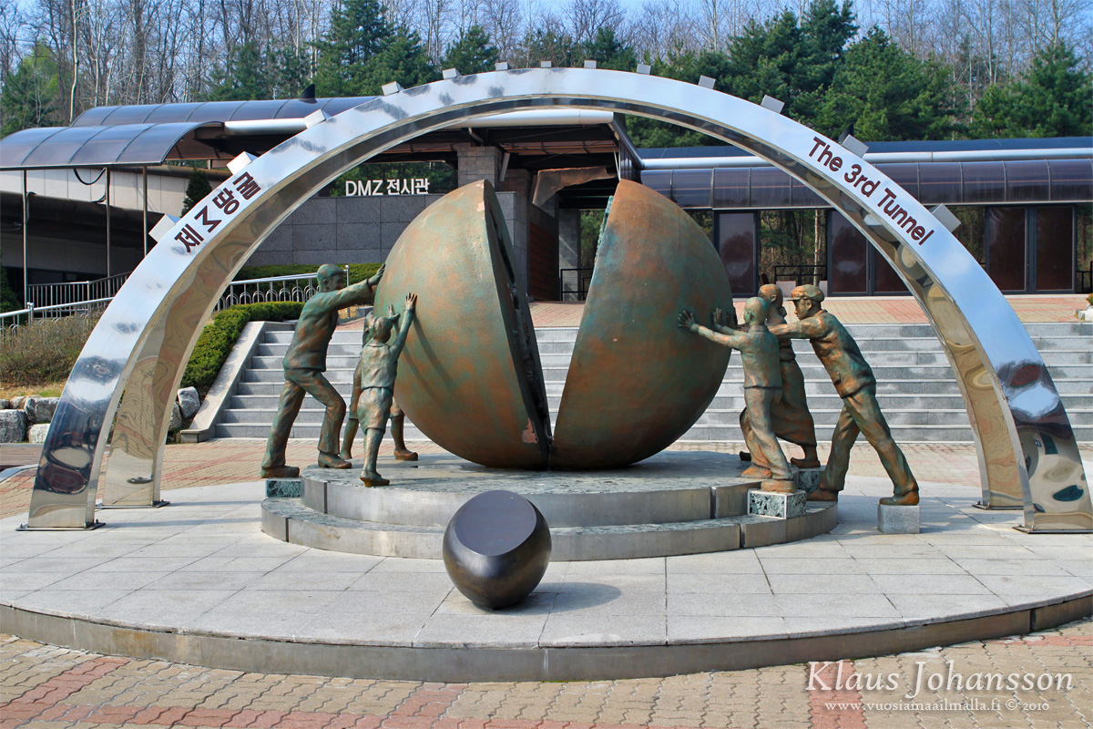
Third Infiltration Tunnel
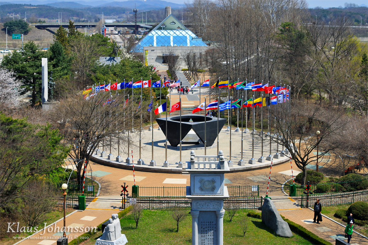
Outside the tunnel a colorful DMZ sign greets the tourists with a statue of Koreans trying unify their separated world countries. Similar South Korean ”propaganda” is visible everywhere along the tour and everything shown is trying to show South Korea as the peaceful nation just trying to live with a crazy and aggressive neighbor to the north. One has to keep in mind that the story told on both sides of the border is only one-sided and both countries practice active propaganda to make their own stance the right one. 💡
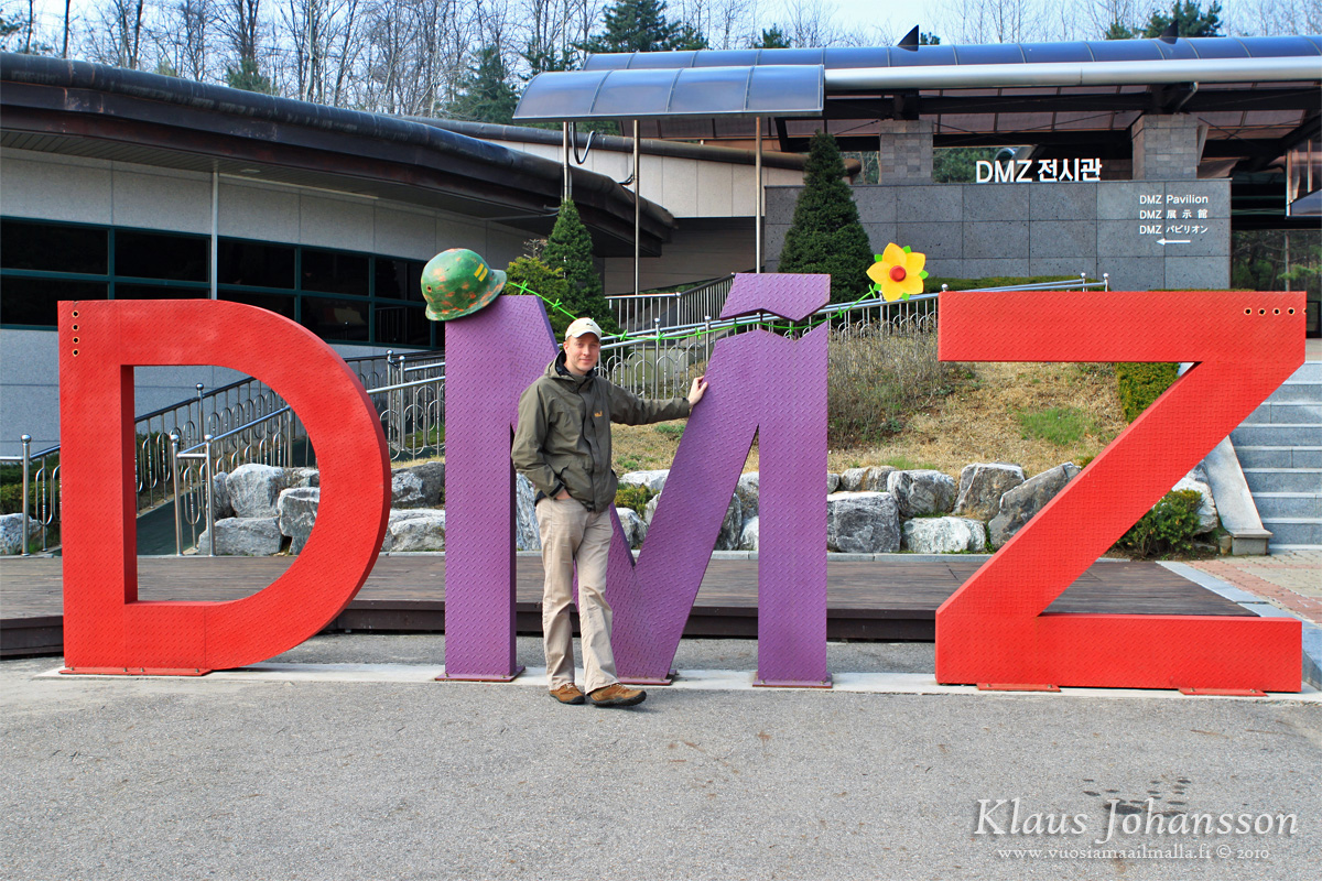
Posing with the DMZ sign
Before entering the tunnel tourists is shown a ten minute video about the discovery of the tunnels. After that one is taken through a small museum where there is some more information on the area. Outside the museum tour participants are given blue helmets, as the tunnel is small and and one will be hitting his head to the ceiling.

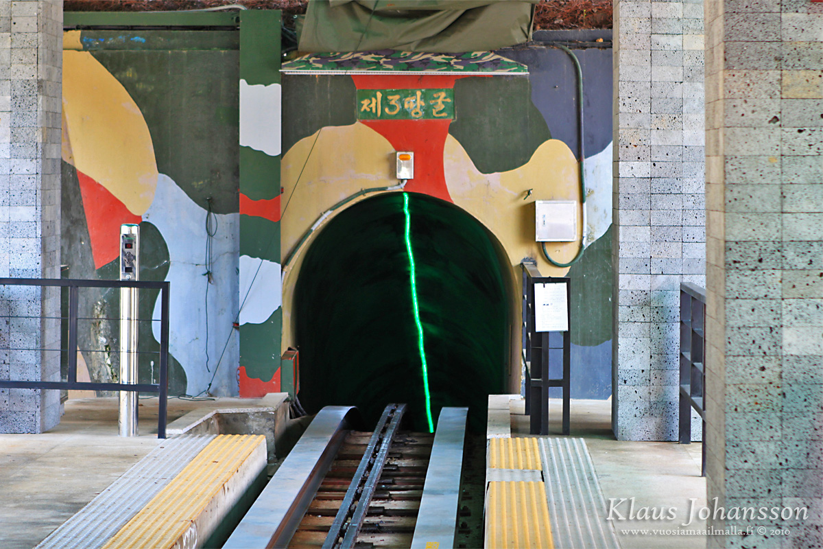
A helmed is mandatory in the small tunnel
Tourists are taken underground onboard a small train through a specially constructed side-tunnel that connects to the real tunnel itself. Before boarding the train one has an opportunity to take a photo next to a warning sign of a live mine field. Don’t get me wrong, I am sure that there are thousands of mines all along the DMZ, but somehow I doubt that there are any right next to a tourist spot such as this. 🙄
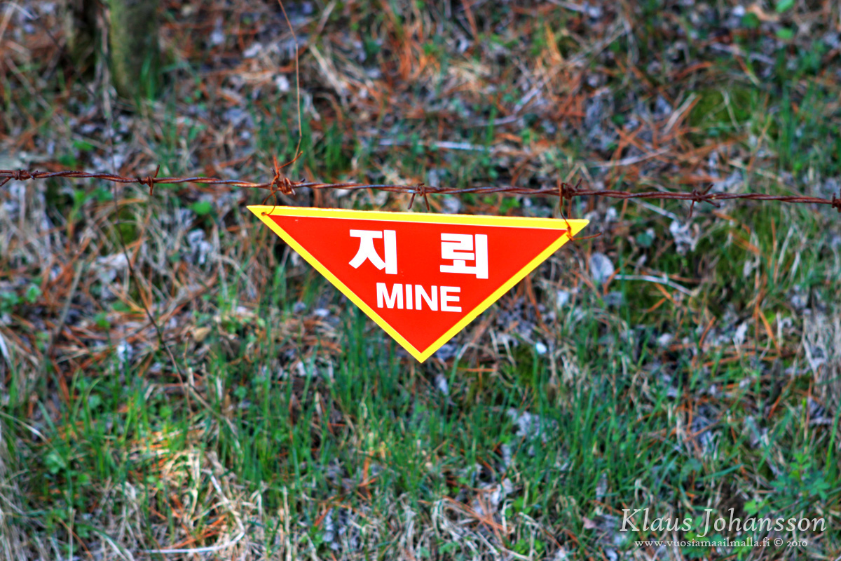
Live mine field
The train takes one inside the tunnel, 73 meters (239ft) below the ground. None of the four tunnels has an open end on the south side, but they have been built almost ready and could be quickly blasted open in case of an attack. Inside the tunnel it is dark and the air is damp. Tourists are able to walk few hundred meters to the first of three thick steel doors that South Korea has built under the MDL to block the tunnel. There is a small window in the first door, making it possible to see the second door, which is presumably followed by the third and final one just under the MDL. In order to keep North Koreans from entering the tunnel and tempering with the steel doors, South Korea is diverting sewage through the doors. It is some dirty tactics but likely very effective. 😀
There is no photography in the tunnel, as supposedly North Korea could then learn more about the structures put in place, but truth be told, there is not much to see in the small tunnel. It’s a tiny tunnel forcing you to walk almost crouching making one wonder on Earth the tunnel could enable moving up to 30 000 soldiers in an hour across the border, as the claim is. Tunnels are too small for any vehicles, but they seem like quite a bottleneck for large crowds of people as well. 😕
There is not that much to see in the tunnel itself, but the reason and story behind it are fascinating. The tour guide is also sure to remind tourists to take a look at the direction of the blast marks and we are also pointed the painted ”coal” on the walls. Last point is also that the tunnel is ever so slightly descending towards north, which is normally done to make the water run out of the tunnel. This is a strong indicator that the tunnel was indeed built from the north.
Why all these details are so important is because South Korea wants to make sure that people don’t think that they have dug these tunnels as part of their propaganda. Without the backup of all these facts the North Korean propaganda machine could be blaming the south, which is now not possible as the facts speak clearly against the north. 💡
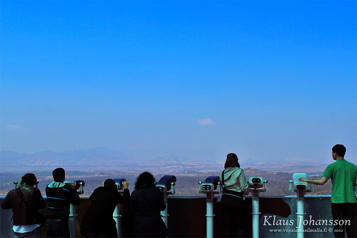
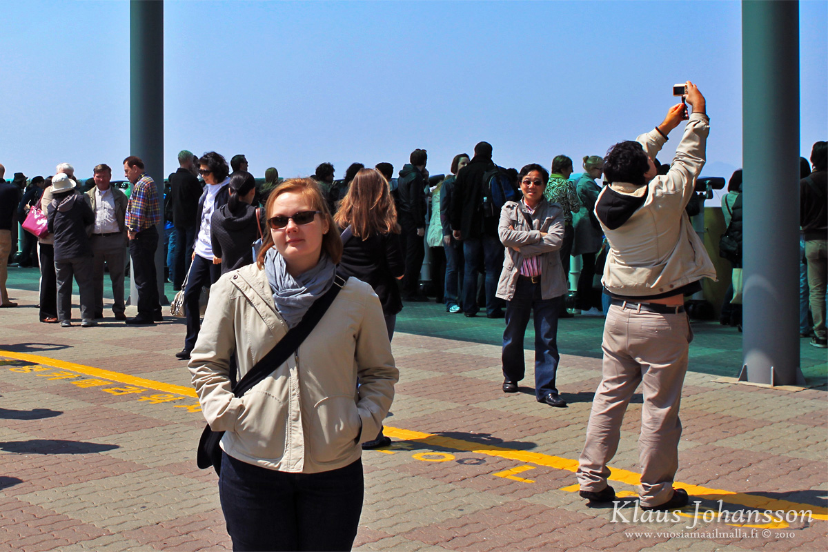
Back above the ground the bus took our group to the nearby Dora Observatory. This observatory on top of a small hill is located at the verge of the DMZ and from there one has an open view to the whole four kilometer wide DMZ and into North Korea. Inside the DMZ there are only two villages: Daeseong-dong on the south side and Kijong-dong on the north. The former is a real village of about 280 inhabitants who, due to their extraordinary location, enjoy complete exemption from all taxes and also active military service. The village is still not a tax haven as its inhabitants must be living there a minimum of 240 day a year to qualify for this special status. Hence the villagers are just ordinary people like farmers and artisans, who just happen to live inside a hot zone.
Observing the North Korean side
On north side the village of Kijong-dong looks at first like a wealthy village, but in reality it is fake with nobody living there. Based on what we were told all the houses are fake and only built to look like houses from this specific vantage point. There are no real rooms or even windows in the houses, although in order to keep up the illusion, there are occasinally actors moving in the village and turning up the lights in the night.
Until year 2004 Kijong-dong had huge speakers that were blasting 20 hours a day the joyful message of greatness of the North Korean leader and telling South Koreans to just walk across the border and be greeted warmly into the socialist heaven. It is not known why the speakers went silent, but one speculated reason has been the chronic lack of electricity in North Korea. Be it as it may, quietness is likely something that the troops working on DMZ appreciate greatly. 🙄
From Dora Observatory one can also see the huge 98.4-meter (322ft) flag pole on South Korean soil. Soon after the flag pole was erected, North Korea responded by erecting a taller, 160-meter (525ft) flag pole, which until 2011 was the world’s tallest flag pole. Nowadays it is only the fourth tallest, but it is still huge with the flag alone weighing ridiculous 240 kilograms (529lb). 
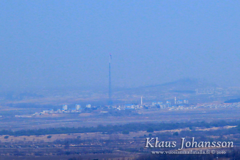
Hazy view of Kijong-dong (better photo in Wikipedia)
All of this is clearly visible from the Dora observatory with one’s own eyes or through pay-per-view binoculars. Unfortunately taking proper photos is challenging, as there are restrictions to taking photos. Inside the observation platform there is a yellow ”photo line” past which point one is not allowed to take any photos. The reason is that the South Korean officials are worried that the foreground would reveal strategic structures which North Koreans could once again find online. The reason is easy to understand, tlhough it does sound a bit silly. Troops on the observatory are still taking the rule seriously and people not respecting the line had their photos erased, so better respect the rule for your own sake. 😯
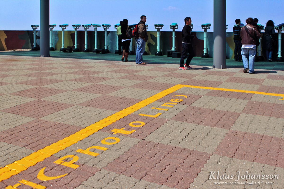
Photos are only allowed behind the official ”photo line”
Regarding photography at DMZ one should note that there are some restrictions for the camera gear allowed. The rule of thumb is that one should not have a camera with a zoom lens with focal length greater than 100mm, which is also being observed. I don’t know how easy it is to sneak in a tiny camera which can today have really serious zooms, but please take note of this and ask your tour company ahead of time to be sure.
I was using my Canon EOS 500D DSLR camera body with a professional Canon EF 24-70mm f/2.8 L lens and it was allowed, although I was given many looks for it. For this particular reason I did leave out my tele-zoom lens which I doubt would have been allowed on the tour. So think about this ahead of time and try confirming if the rules have changed. It will ruin your day if you won’t be able to use your camera.
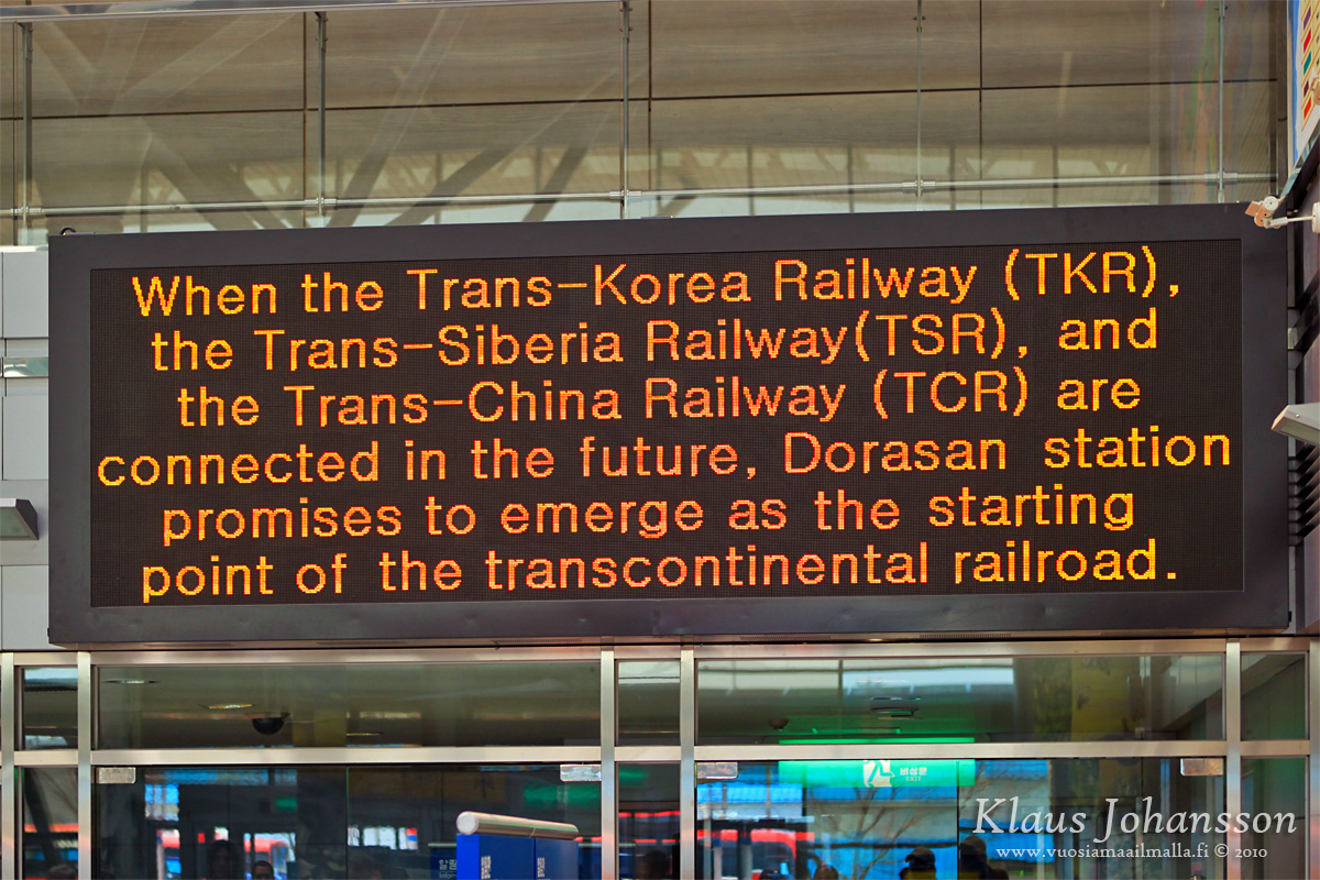
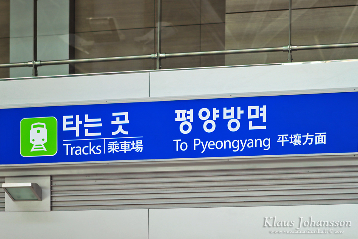
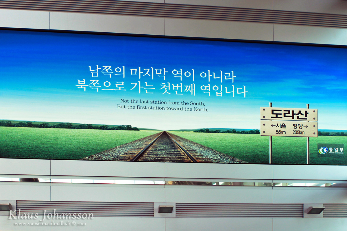
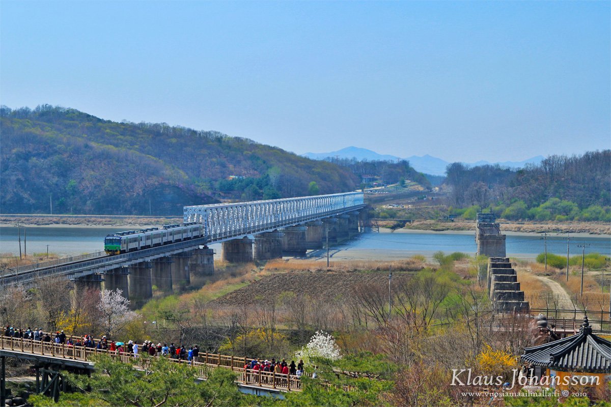
Next stop was the Dorasan Station nearby, which is the last train station before DMZ. The line leading to the border is known as Gyeongui Line and it used to be the most important in all of Korea, connecting Seoul and Pyongyang. However after the separation all traffic on this line ceased, but as part of the the remediation of the relationship between the two countries, in 2007 a train crossed the border for the first time in decades. Traffic on the line is still minimal and due to the relationship again getting colder in recent years, traffic is currently stopped. Even when running, the line is not providing any service for tourists and is only being a symbolic freight train to the Kaesong industrial park on North Korean side.
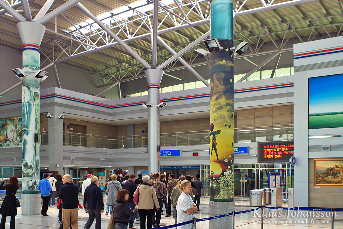
Dorasan Station
Kaesong industrial park is located ten kilometers on the North Korean side and is still largely under construction. As a symbol of collaboration South Koreans started funding a new industrial park back in 2003 with the intention to provide thousands of North Koreans with employment and bring some wealth into this poor country. Of course one should not be naive to think that it had nothing to do with it that the cost of labour in North Korea is half the price of China and twenty times cheaper than in South Korea. Due to that labour is almost free which is why many South Korean companies have joined the this symbolic venture. 💡
One day Dorasan will be a great station
Already today the area is employing approximately 40 000 people, but once fully completed, the area could employ as many as 725 000. 😯 Currently factories in Kaesong are manufacturing mostly thing like shoes, clothes and watches. All materials are being delivered from the south (including electricity) and all goods return to south for selling and exporting.
The project has been a semi-success although in recent years it has faced some hurdles due to the cooling relationship. Because of that Dorasan Station remains currently unused and for visiting tour groups to wonder. On station walls optimistic posters and signs still keep the hope up for one day the station serving on the line to Pyongyang and further towards Europe via the Trans-Siberia Railway. Today, that day still feels like a lifetime away. 🙄
Optimistic posters and signs
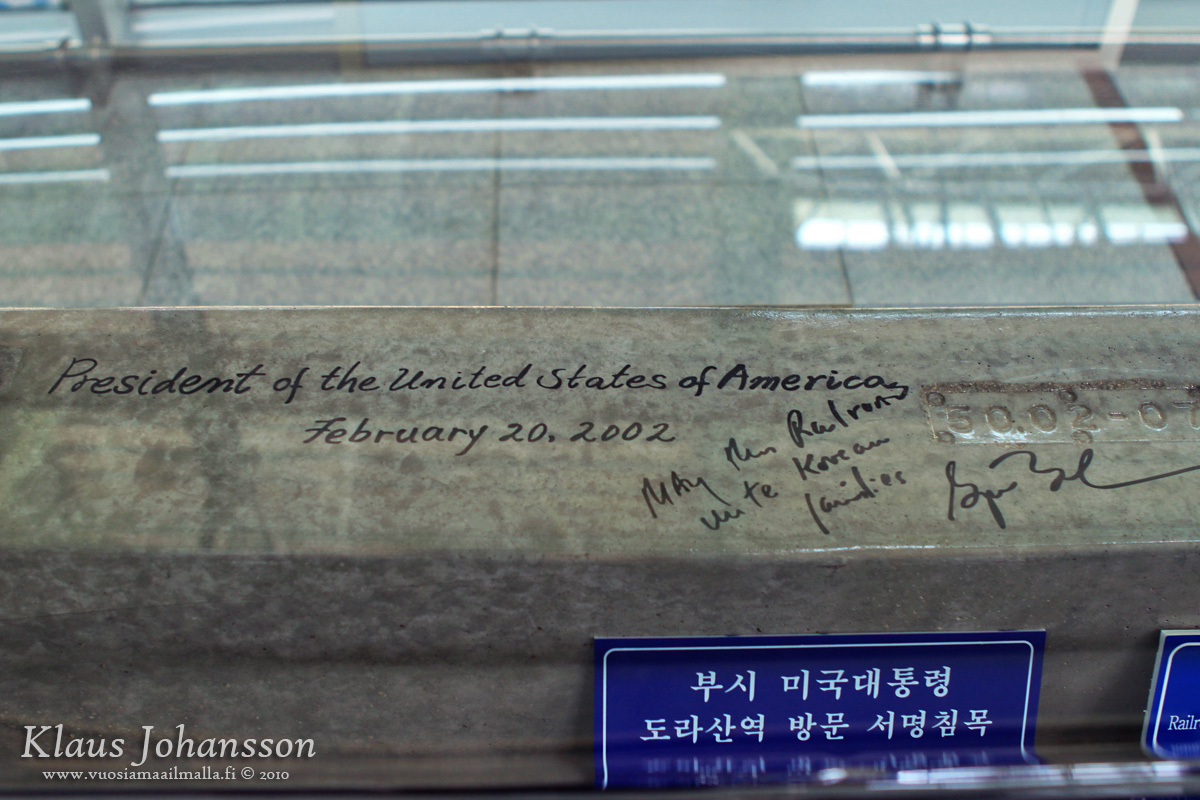
Dorasan station gained some notoriety in 2002 when the George W. Bush visited the station as a sign of United State’s continued support for South Korea. The visit made many people very nervous as it took place shortly after Bush had declared North Korea being part of the ”axis of evil”. Despite the anxiety the visit went without any drama and only a photo of the event and a piece of railway remind of it. Upon his visit Bush signed the piece of concrete and the photo taken makes it look like he is shaking hands with someone. Taking a photo of this illusion is a popular habit for tourists visiting Dorasan Station. Tourists are also able to get a commemorative stamp from an office at the station on a paper, bill or whatever.
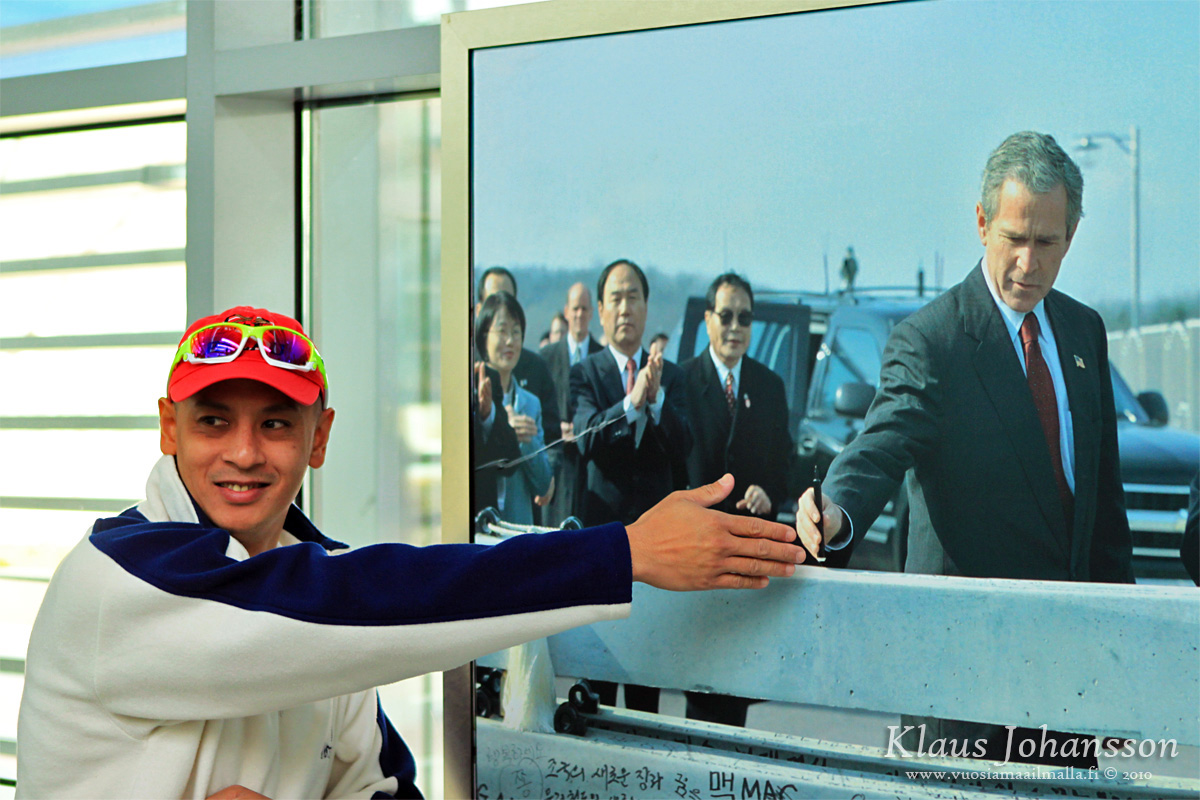
Shaking hands with POTUS
After Dorasan Station we were taken for a lunch slightly outside of the DMZ. Tourdmz’s tour includes everything during the day and also an authentic Korean lunch is provided in a small inn nearby. Food is good and we had good time mingling with other tourists.
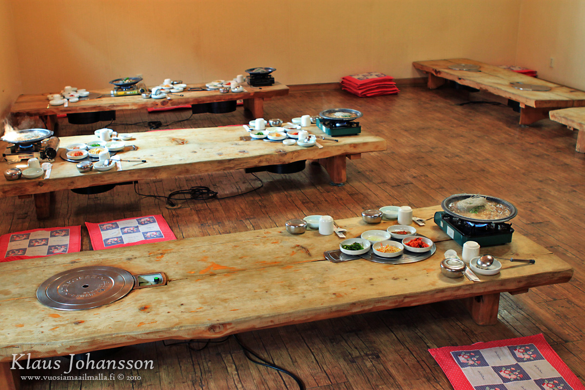
Authentic Korean lunch is included
After lunch it was time to return to check our another railway bridge, called the Freedom Bridge. This bridge is located along the Gyeongui Line, just before Dorasan Station. The bridge is not that interesting, but this is the furthest place that non-tour visitors can reach on their own. The place has a huge food court and a small fair, which felt a bit unusual considering the location. It still makes for an interesting stop and one can check an old locomotive that was destroyed in the Korean War. There is also some information about the fences used on DMZ which is interesting.
Freedom Bridge
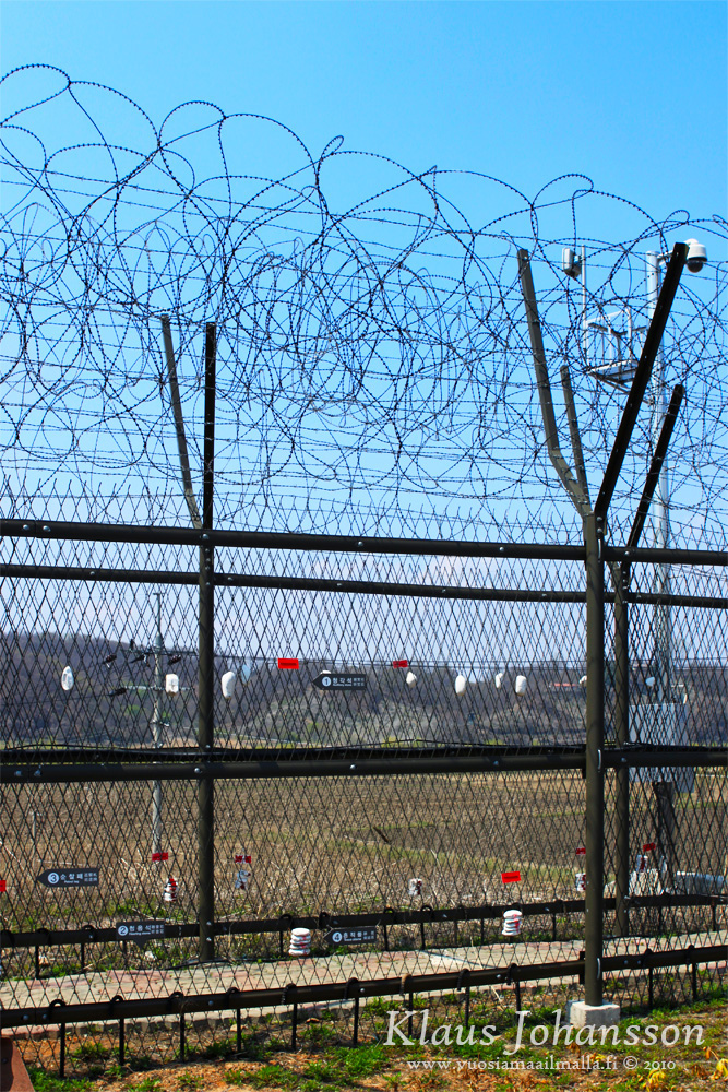
Example of a fence used on DMZ


Freedom Bridge area feels like a county fair
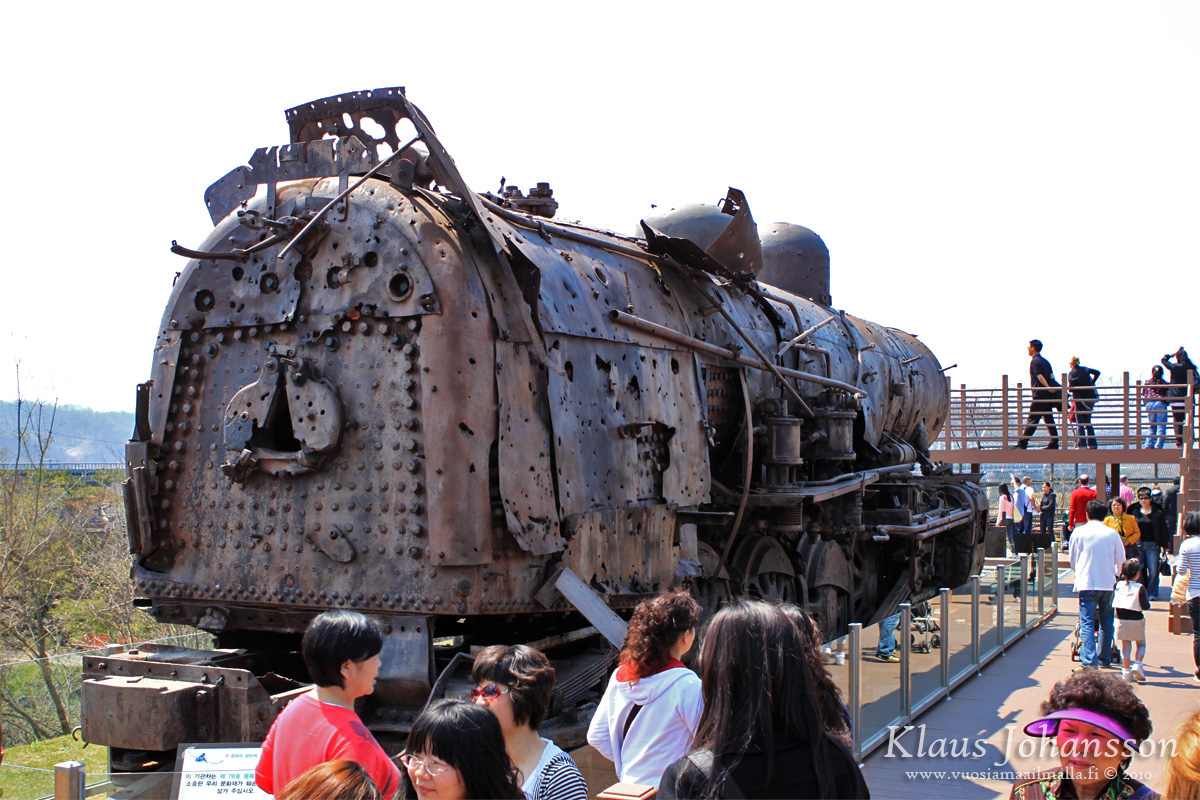
Destroyed locomotive
During the first half of our day we had already seen plenty, but technically we had not yet set our foot inside the DMZ (excluding the visit to the Third Infiltration Tunnel which runs under DMZ). Visiting the DMZ is of course the highlight of the tour and that would be the next stop. 🙂
So once again we boarded our bus which now headed towards the DMZ border. On the way we made a stop at a military checkpoint where a soldier boarded our bus. Once again our passports were checked and also our cameras were being checked for lenses with focal length not greater than 100mm. After passing the check, we were taken to the Camp Bonifas military base where we were appointed a soldier that would be our guide during our visit to Panmunjom and the Joint Security Area (JSA) directly on the border with North Korea.
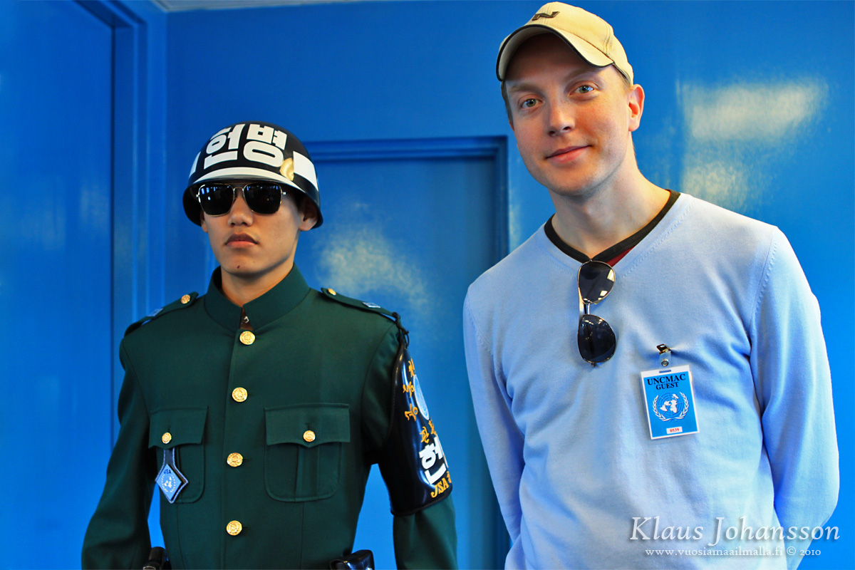
Inside the military base we were showed a small Powerpoint show about the JSA and security measures that we would have to follow. We also had to sign a liability waiver for the United Nations in case anything would happen to us during the visit – like getting shot! One is able to keep this waiver after the tour, which makes for a nice memorabilia. After giving our signature we were given badges stating that we were visitors of the United Nations. 🙂
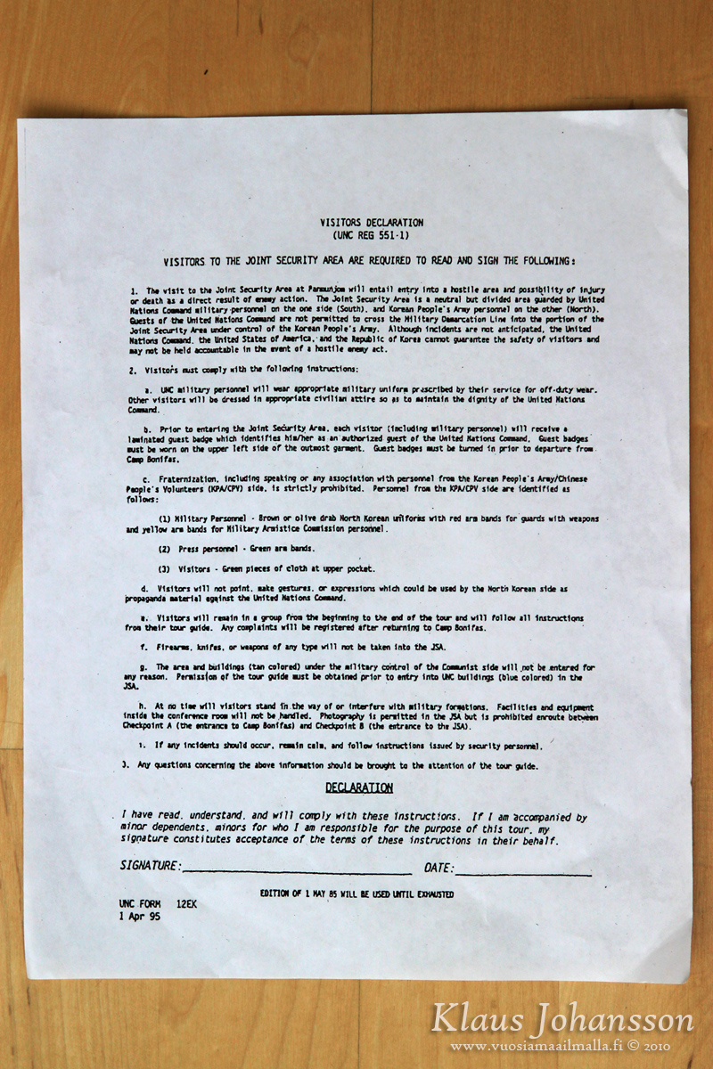
Waiver for your life etc.
After this we were rushed back to the bus. All visits to the JSA are carefully coordinated, so we had to do some hurrying. There is no taking photos inside Camp Bonifas or during the short drive to JSA, so we just had to use our eyes. On the way we passed a small three-hole golf course that bears the title of being ”the world’s most dangerous golf course”. The title comes from the fact that the course is surrounded by mine fields on three sides, so there is no searching for your ball from the bushes. 😆
After the base there is one more checkpoint and only then are we officially inside the DMZ. The demilitarized zone is basically wilderness as the four kilometers wide and 248 kilometers long zone has become a perfect nature reserve where thousands of animals have found shelter. According to specialists there are 2900 plant, 70 mammal and over 320 bird species, including even large animals like leopards and bears! 😯
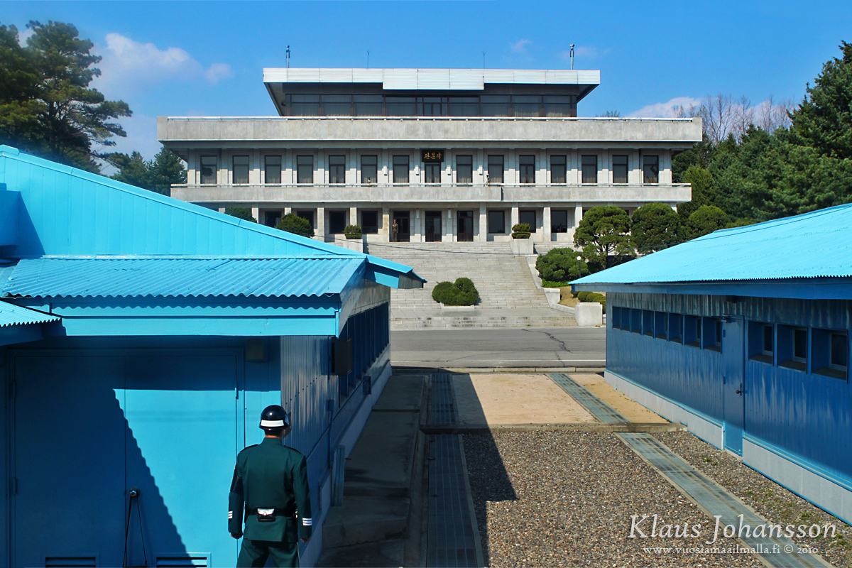
From the DMZ border there is a fifteen minute ride to the JSA which is also sometimes called ”Truce Village”. The area is located at the place of the former village of Panmunjom which was destroyed in war. Today the area includes a small purpose-built village for peace talks and is the only place along the whole DMZ border where South and North Korean soldiers stand face-to-face. This is also the official location for any talks between the two countries, which is why the buildings have been built there. The largest of these is called Freedom House, behind which our bus parked.
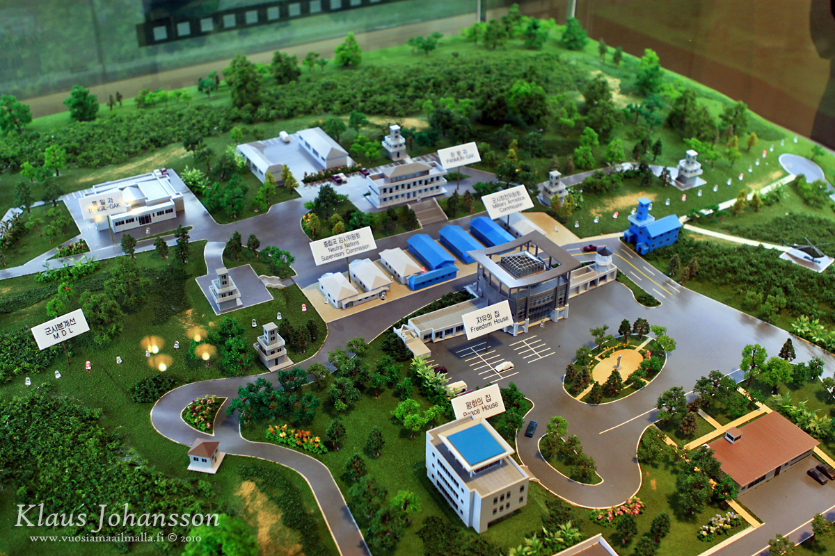
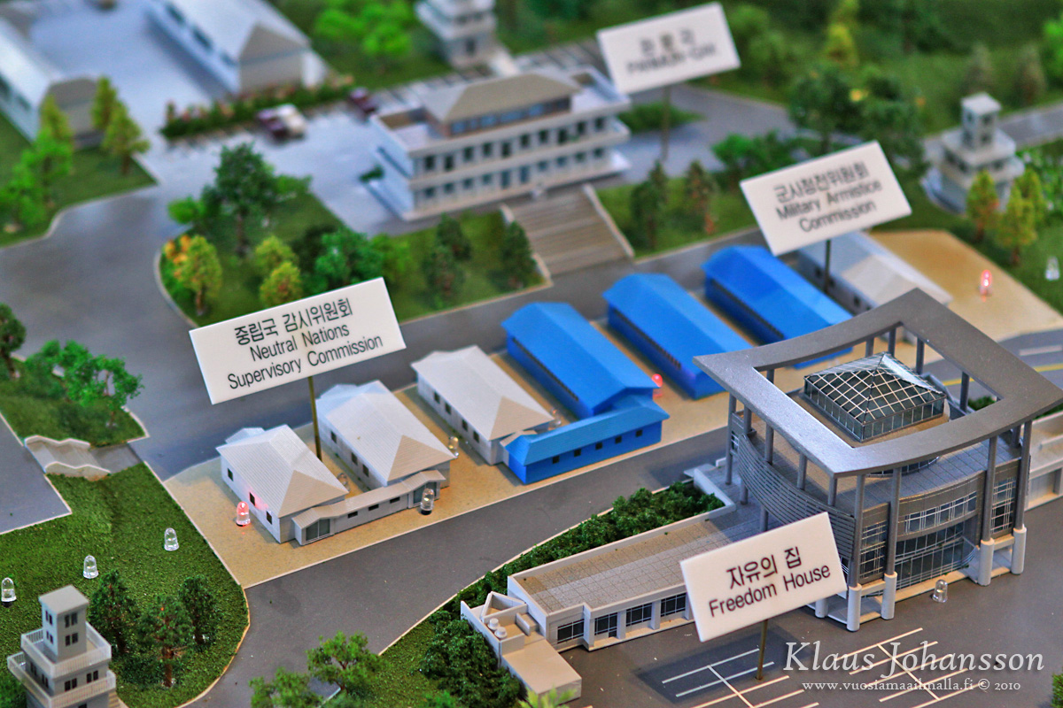
Model of the JSA area
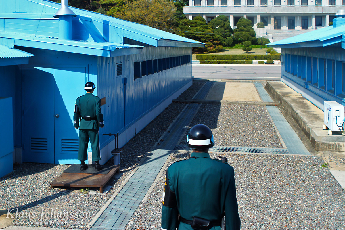
At this stage the shit gets real and there is no smiling anymore. Tourists are told to walk in pairs and walk promptly and not to stop for any reason. Anything else might potentially be viewed as hostile by the North Koreans, as silly as it sounds. I should also mention that there is a strict dress code on the tour and no t-shirts with text, military uniforms or even shredded jeans are allowed as well as too revealing clothes. ❗ The idea is to prevent provoking the North Koreans with anything and there is absolutely no exceptions to these rules. Once again, ask your tour organizer for more guidance on this.
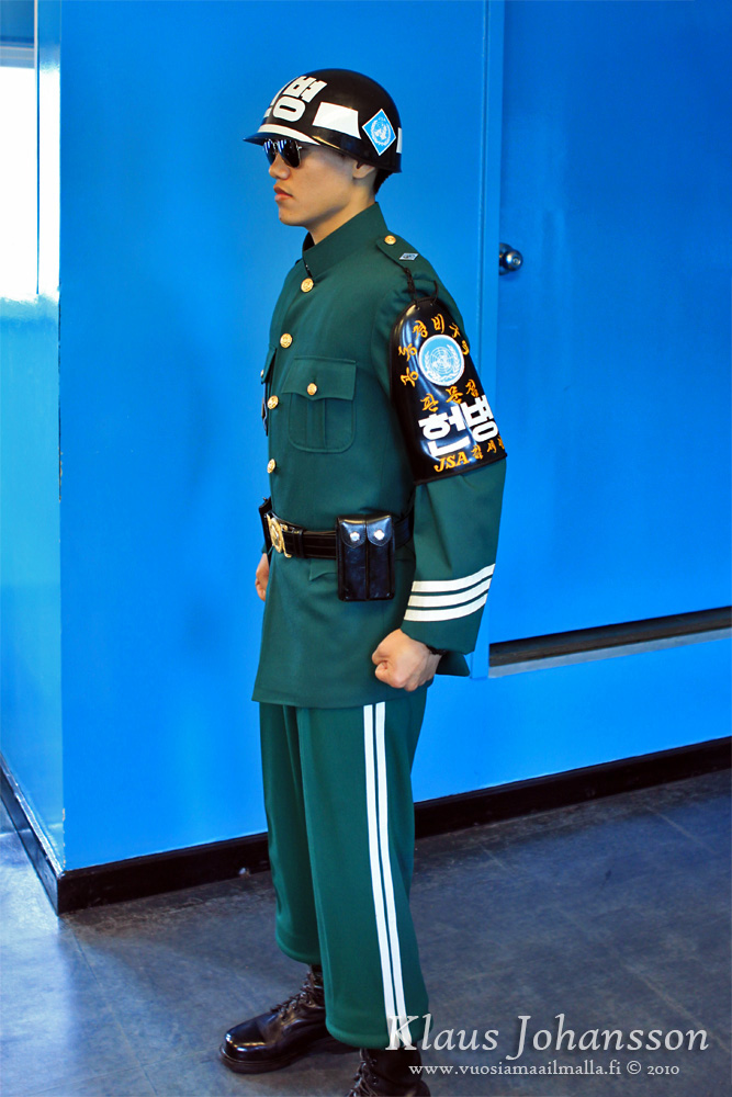
As we walked towards the blue building in the middle of the area we were only allowed to look and not say or do anything else. Also the soldiers serving on the border have tight rules guiding all their actions. On south side the soldiers have to be over 177 centimeters (5ft 9.6in) in height, which is the average height of a North Korean soldier. Every soldier also has a black belt either in Tae Kwon Do or Judo for any situation. Soldiers also carry armed pistols and have all dark sunglasses. Standing in a tight Tae Kwon Do pose, they are supposed to be intimidating the North Koreans not to do anything stupid.
On north side of the border the soldiers are well-fed so that they wouldn’t appear thin and weak like a regular North Korean. Every soldier is also facing another soldier, so that someone can see someone else at all times. This is to prevent soldiers from defecting to the south. North Koreans seem not worried about south making a surprise attack on them, so soldiers are even standing with their back towards the border. On south side this is unthinkable and all soldiers are only facing north, most of them partially covered by the buildings.
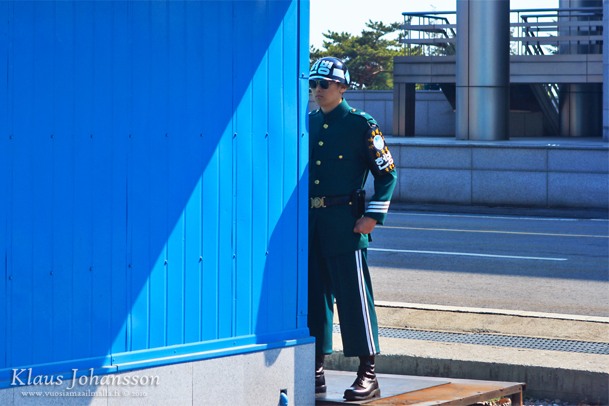
South Korean soldier guarding the border
Before tourists arrive in the small building, the northern door of the room has been locked by two South Korean soldiers. They perform locking the door hand-in-hand so that there is no chance of anyone pulling the door open and taking a soldier hostage. After the door is locked, one of the soldiers remains at the door and the other one goes standing in the middle of the room.
Inside the room there are also strict rules to follow. As the building and the room is located on top of the MDL, the northern side of the building is officially in North Korea. Tourists are allowed to move freely and even enter the North Korean end of the room, but nobody is allowed to go behind the soldier guarding the door. The reason is that a tourist defecting into North Korea would be international news and a scandal. One old lady in our group made the mistake of going too far and was shouted at by the soldier. The situation was tense for a moment as these guys are not kidding aroud!
Door to North Korea

Soldiers in a tight Tae Kwon Do pose
One is allowed to take photos of the soldiers and anything in the room. Even posing with them is allowed, but one must not touch them or go behind them. From the window one can see the MDL which is the official border with North Korea.
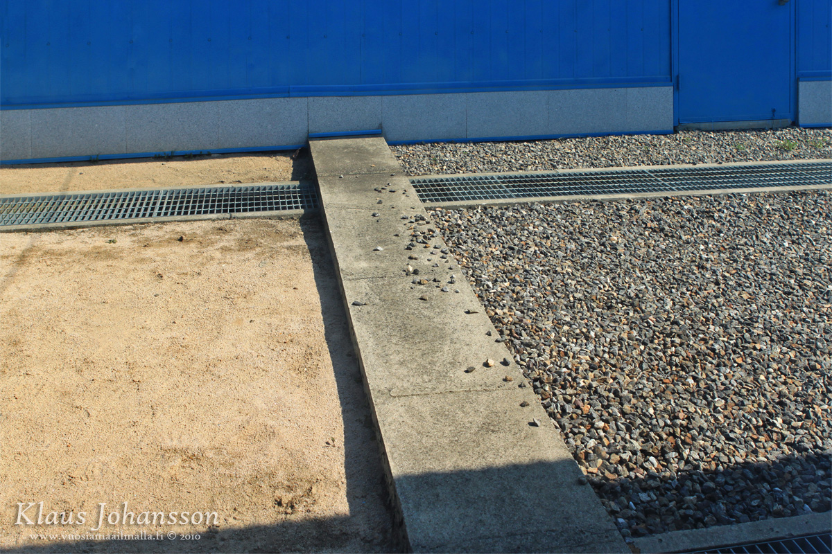
The official border MDL
Visit to the room lasts only about ten minutes and is the whole time controlled by the soldiers. There is information about the high-profile meetings that take place in the room and one funny story was around the flags on the South Korean side of the room. In the past there was an incident where the South Korean and American flags were being tarnished by the North Koreans using the room at that time. Because of this the flags were replaced with plastic versions so that further tarnishing would be challenging.
Plastic flags
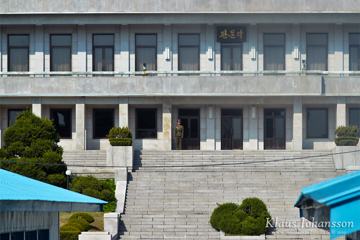
After ten minutes we had to leave the room the same way we had come in and enter the Freedom House. On the eastern patio our guide was telling us how we are all the time being watched by the North Koreans, even though it didn’t apper like antyhing was going on. The only North Korean soldier that we were even able to see was a lone soldier standing in front of the Panmon Hall building on the North Korean side.
For this reason the guide is unable to point to any of the things he is telling us about and is only referring to the clock directions. The reason for this is that the North Koreans might be taking photos of the pointing soldier and Photoshop it to look like he would be giving them the finger – adding to the propaganda in North Korea, depicting South Korean and American soldiers as arrogant and bad mannered. 😯
At JSA your every move is being watched
The tour doesn’t spend long time on the patio either and altogether we spent may be fifteen minutes at the JSA. Upon leaving the area the bus drives slowly in front of the Freedom House and this is the only time one is allowed to quickly take as many photos as possible. Fortunately the guide is giving a heads-up, so one is able to take few quick snaps.
View towards North Korea
Only a short distance from JSA is the Bridge of No Return which is where the north and south exchanged prisoners of war after the armistice. The name derives from the fact that many North Korean prisoners were not willing return to north. They were given the choice to remain in south, but if they chose to return, they would not be allowed to return to south ever again.
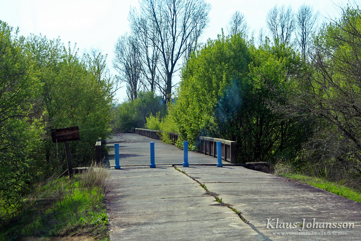
Bridge of No Return
The bringe is also known for a bizarre incident called The Axe Murder Incident that occurred on August 18th, 1976. Back then the whole JSA area was still shared by both sides and soldiers from both sides were moving fairly freely between different guardhouses in the area. Unfortunately a poplar tree had grown too large and prevented two South Korean guardhouses from seeing each other. Because of that a small group of soldiers was ordered to trim the tree.
For some reason the trimming operation led to North Korean soldiers getting provoked and two Americans were killed – one by an axe used to trim the tree. Confusing and escalating situation led to South Korea closing the Bridge of No Return from North Korea which led to some of their soldiers being stranded in their guardhouses. North Korea was forced to build a temporary 72 Hour Bridge (in 72 hours) to re-gain access to those guardhouses.
The next day after the incident tthe Americans carried out Operation Paul Bunyan where 813 soldiers went together to cut down that damn tree and clear the area, to which North Korean soldiers didn’t dare to say or do anything. The escalation was over, but it was a big scandal that is well described in Wikipedia.
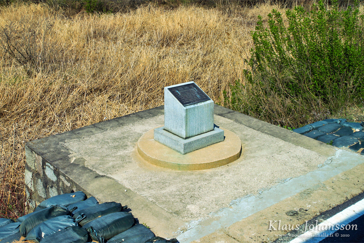
Sign where the poplar tree once stood
One is not allowed to disembark from the bus, but you can take a photo of the location of the former poplar tree from the bus. After this the bus returns to Camp Bonifas which is named after the Major Arthur George Bonifas who died in the incident.
Finally the tension begins to cool off as the crazy North Koreans at the border are left behind. Thinking about all the rules on the JSA they may seem harsh and even ridiculous, but they are all in place to prevent incidents and propaganda from happening, which both have taken place so many times in the past. Tourists are also constantly reminded ”not to get on CNN today” as any incident at the border could easily be international news. One can hope that tourists understand to respect and follow the rules as otherwise further tours might be cancelled. So don’t be stupid while visiting the border so that also others will get the chance go and witness this bizarre stalemate between two countries.
Back at Camp Bonifas one is taken to a souvenier shop (of course!) where they sell everything related to JSA and Panmunjom. Some of the products are claimed to have been manufactured in North Korea, like some candies and official North Korean paper bills. We bought both and gave the candies to our colleagues back home. As none of them died or fell ill, I suppose the candies were harmless. 🙂
After some shopping it is back to Seoul. During the drive back it is good to think about everything seen during the day. First thought is how absurd the whole separation is and how ridiculous rules and incidents it has created. It is very similar to the Berlin Wall, which has been gone for over 25 years. Could DMZ also be one day gone and anyone be able to cross the MDL freely, like in today’s Berlin? Perhaps.
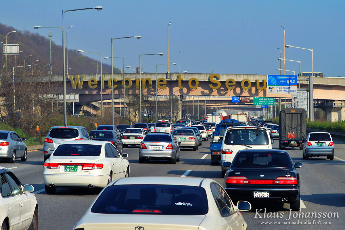
Congestion on the way back to Seoul
We were also curious to ask our tour guide what she and the South Koreans think about the situation. The answer is of course subjective, but at least she is not hoping for a fast reunification. The difference in wealth between the north and south is just so massive that an unification would be extremely expensive to South Korea. This was also the case for West Germany and people there are still paying a special tax to compensate for rebuilding former East Germany to the same standards as west.
There is also a huge lack of trust between the two countries. Our guide told us about a North Korean defector living nearby her, who from the outside appears happy about his new life in the south. However the guide admits that she cannot be 100% sure that this is genuine and he is not a North Korean spy, which do live among the South Koreans. The wounds are deep and having lived in Germany myself, I have to say that even there people from former DDR are sometimes being treated differently – 25 years after the Wall fell! 😐
We were back at our hotel in the late afternoon. Both of us agreed that tourdmz’s tour was exceptionally well organized and a truly unique experience that one can warmly recommend to anynone visiting South Korea. All the information provided was detailed and interesting, although one one has to keep in mind that the perspective given is purely South Korean and it is common to demonize the crazy North Korea. Even in DDR life wasn’t miserable all the time, as people often think, so I doubt North Korea is as crazy as some of the media stories make it sound. Propaganda is being spread on both sides which is why the topic is so sensitive and one has to make up his own opinion.
Of course I do believe that it is the north who is the aggressive one with a failed system, and reunification is inevitable. Unsure though is whether it will eventually happen peacefully or through military action. I am hoping for the former but with a situation this complex, one can never be sure about it.
I hope you enjoyed reading about our visit to the North Korean border. We did also enjoy our time in Seoul, which is a very modern global city that I can highly recommend. If you have any questions to me, please use the comment section below. Thank you! 😛
All other blog posts from our trip to Japan and South Korea (in Finnish) in here.